Artificial Intelligence, Deep Learning & Machine Learning Solution Company!
Exploring Minds Artificially...


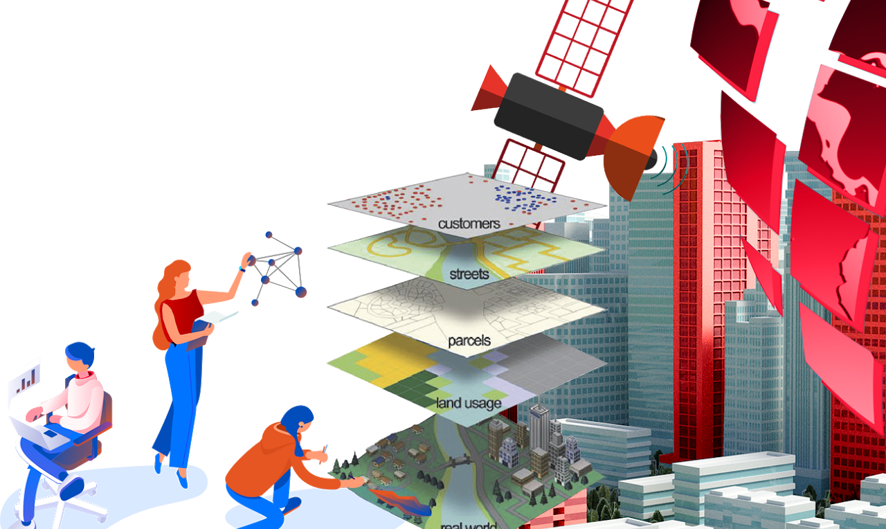
Geographical Information Sytem with Artificail Intelligence & Deep Learning!
![]()
Deep Learning Technologies Based GIS Application System
An AI & Most Modern GIS Technologies based solution to analyze satellite imagery in unprecedented ways to derive various demographic and social metrics for a given location. Count objects & features, classify a city into different settlement types e.g. Apartment vs Villas vs Small Homes, Slums Vs Planned Settled areas, residential Vs industrial. Analyze Agriculture Land and Crop, Analysis of Land utilization Parks Vs Sports Fields Vs Water Ways.
Powerful Analysis to optimize your business Reach & Access. Ideal
for Town Planners, for infrastructure and utility services planning for
a district or a real-estate project. Geographical information system is
on the most power tool to analyze the population and their trend. Our
AI based solution Planet Scan is a AI GIS based geographical information
system that has been developed on deep learning and machine learning methodology.
This system works according to the selected region anywhere in world and
provide the complete detailed information about people, gender, houses,
market, shops, entertainment places, parks, playgrounds etc. and then
assessment is also being done by this product. You can upload your data
layers for analysis never seen before.
Our solution is one of the most amazing solution which
has been developed on AI technology by using the deep learning and machine
learning techniques. For enquiry and demonstration, please email us at
[email protected]